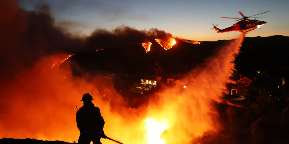
Three more fires have erupted in Los Angeles, San Diego, and Riverside counties. One of the measures being used to contain them is the deployment of aircraft that drop water from above.
As wildfires continue to ravage Los Angeles, three new ones have been reported in Hughes, Bernardo, and Clay in California. Here’s what we know about each fire and the measures being taken to extinguish them.
On January 22, 2025, the California Department of Forestry and Fire Protection (CAL FIRE) announced on X, formerly Twitter, that a new fire had broken out in the Castaic area, affecting 3,407 acres.
CAL FIRE reported that evacuations are underway, and it, along with its federal partners, has deployed “pre-positioned resources on the initial attack of this fire.” The department is also collaborating with Angeles National Forest, as well as local, state, and tribal partners to contain the blaze.
NEW FIRE in Los Angeles County
🔥#HughesFirehttps://t.co/RAT4A0J3L2
* Castaic area (LA County)
* 3,407 acres
* Evacuations underwayCAL FIRE and local and federal partners are using pre-positioned resources on the initial attack of this fire.
Residents should sign up for… pic.twitter.com/tuemeFOHiz— CAL FIRE (@CAL_FIRE) January 22, 2025
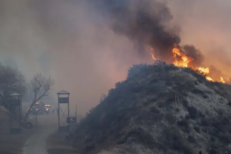
Alongside a map showing the affected areas, CAL FIRE urged residents to sign up for Los Angeles County emergency alerts. In an update published on the same day, the department stated that the fire is impacting two counties—Los Angeles and Ventura.
At the time of the update, only 14% of the fire was contained, with 10,176 acres burned. The brush fire is located off Lake Hughes Road, north of Castaic Reservoir Road in Castaic. In addition to CAL FIRE, the efforts to combat the Hughes Fires involve the US Forest Service and the Los Angeles County Fire Department.
The Los Angeles County Sheriff’s Department and the California Highway Patrol, Southern Division, also lent a hand. Residents are strongly advised to evacuate to protect their lives and property. They are urged to leave immediately and take their pets and livestock with them.
The following zones have been placed under evacuation warnings: CAS-CAMBRIDGE, CAS-GOLDENSTATE, CAS-GREENHILL, CAS-HASLEY, CAS-HILLCREST, CAS-INDUSTRY, CAS-LIVEOAK, CAS-OAKCANYON, CAS-ROMERO, CAS-SLOAN, CAS-VALVERDE, GOR-E004, and GOR-HUNGRYVALLEY.

Additional areas under evacuation warnings include LAC-E005, LAC-E009-B, LAC-E011-A, LAC-E011-B, LAC-E017, LAC-E018, LAC-E030, SCL-BLACKPINE, SCL-CALEX, SCL-DECORO, SCL-MOUNTAINVIEW, SCL-PACIFICCREST, SCL-RANCHOTESORO, SCL-REYESABODE, SCL-RIONORTE, SCL-WESTHILLS, SCL-RYE, and VNC Zones 2 through 8.
The designated evacuation center is the College of the Canyons East Gym, located at 26455 Rockwell Canyon Road, Santa Clarita, California.
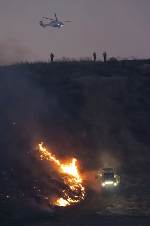
In an update on January 23, CAL FIRE reported that as of 1 p.m. the previous day, the department had deployed four hand crews, bulldozers, 20 pre-positioned engines, and aircraft to support firefighting efforts.
The department stated, “In total, more than 1,100 firefighters were strategically pre-positioned across the region to address the ongoing critical fire weather under Red Flag Warnings.”
The start and rapid growth of the #HughesFire in Los Angeles County seen from ALERTCalifornia's Whitaker Ridge camera. Check conditions live on multiple cameras at https://t.co/Azu4PbZNY7 and look to @Angeles_NF and @LACOFD for updates. pic.twitter.com/JyKOpyY2jx
— ALERTCalifornia (@ALERTCalifornia) January 22, 2025
Center Fire or Bernardo Fire, San Diego County
On the same day that CAL FIRE announced the Hughes Fire, the City of San Diego Fire-Rescue Department (SDFD) reported a blaze in Bernardo. In an X post, the department stated, “A brush fire has erupted in the rancho Bernardo. Potential for 100 acres. [sic]”
So far, one person has been hospitalized after suffering burn injuries. The department also warned that structures were threatened and evacuations were imminent, sharing a picture of black smoke billowing on the horizon.
CENTER FIRE: a brush fire has erupted in rancho Bernardo area. Potential for 100 acres. One person transported to hospital with burn injuries. Structures are threatened. Evacuations imminent. pic.twitter.com/4asEKtoZql
— SDFD (@SDFD) January 22, 2025
CENTER FIRE: a brush fire has erupted in rancho Bernardo area. Potential for 100 acres. One person transported to hospital with burn injuries. Structures are threatened. Evacuations imminent. pic.twitter.com/4asEKtoZql
— SDFD (@SDFD) January 22, 2025
Later that day, SDFD posted footage of firefighters and personnel tackling the blaze from the ground and the air, with airplanes dropping water. It confirmed that the official name of the Bernardo Fire is the Center Fire.
According to the department, the quick response by air units has been instrumental in containing the blaze, which continues to threaten homes. While most evacuation orders have been lifted, seven acres have been burned.
CENTER FIRE UPDATE: A fast response by air units helped quickly contain the #CenterFire. Homes were threatened. Most evacuation orders lifted. 7 acres burn. Crews will be in the area through the afternoon/evening. Remember to always have a fire plan & be prepared to evacuate. pic.twitter.com/o9vaDj8j2a
— SDFD (@SDFD) January 22, 2025
Fire crews are expected to remain on-site throughout the afternoon and evening. However, residents are advised to have an emergency fire plan and be prepared to evacuate if necessary.
On January 23, the San Diego Police Department confirmed that all evacuation orders and warnings had been lifted. But Camino Del Norte road closures will remain in effect. First responders continue working in the area, and residents are advised to proceed with caution.
**UPDATE 3**
SDPD – Center Fire in RB Update: All evacuation orders and warnings have been lifted.
Road closures will remain in effect on Camino Del Norte.
First Responders will continue to be working in the general area, please use caution. pic.twitter.com/DOccNoy7Qz
— San Diego Police Department (@SanDiegoPD) January 22, 2025
Two days earlier, San Diego County experienced three separate fires that led to evacuations and extensive firefighting efforts. The fires broke out in Lilac, Pala, and Friars.
According to CAL FIRE, the Lilac Fire started at 1:19 a.m. near Old Highway 395 and Lilac Road in Bonsall, burning 85 acres. Evacuation orders and warnings were issued earlier in the day. In an update from CAL FIRE/San Diego County Fire, containment was reported at 50%.
#LilacFire [update] The fire remains 85 acres and is now 50% contained. pic.twitter.com/zDlA2Rgcln
— CAL FIRE/San Diego County Fire (@CALFIRESANDIEGO) January 22, 2025
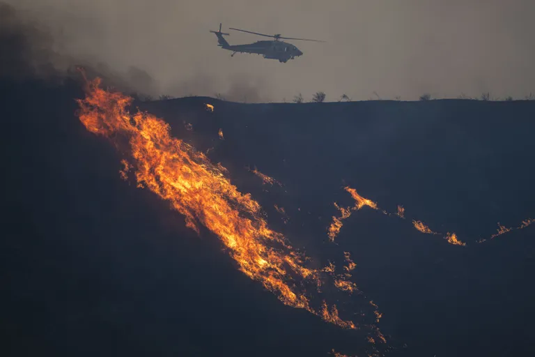
Firefighters deployed aerial units, monitored the perimeter, and analyzed wind conditions to contain the fire. Authorities are still investigating its cause.
On January 22, CAL FIRE provided an update on the Lilac Fire, reporting that containment had reached 90% of the affected acres.
Firefighters continue to progress in containing the wildfires impacting Southern California. Here is a summary of the major fires burning in California including the #PalisadesFire #EatonFire #LilacFire #ClayFire #LAFires pic.twitter.com/cMoCZZYeLM
— CAL FIRE (@CAL_FIRE) January 22, 2025
Clay Fire, Riverside County
On Wednesday, the Official Incident and Safety Message Site for CAL FIRE and Riverside County Fire Department warned residents of a new fire via X. The department shared a map and described it as a vegetation fire that started at 5 p.m.
The fire began at Van Buren Boulevard and Clay Street in Jurupa Valley. Firefighters responded promptly, tackling two acres of burning vegetation along the river. “The fire is in heavy fuels and burning at a slow rate of spread. No structures [are] threatened,” the department noted.
VEGETATION FIRE – rpt @ 5:00PM. Van Buren Blvd / Clay Street in Jurupa Valley @jurupaValleyGov. Firefighters are on-scene of 2 acres of vegetation burning in the river bottom. The fire is in heavy fuels and burning at a slow rate of spread. No structures threatened. #ClayIC pic.twitter.com/b5UcxY9wfk
— CAL FIRE/Riverside County Fire Department (@CALFIRERRU) January 22, 2025
About an hour later, the department updated residents, stating that the blaze had spread to 38 acres, and continued burning heavy vegetation. Evacuation warnings were issued for RVC-177, RVC-178, RVC-179, and RVC-181.
#ClayIC [UPDATE]: The fire is 38 acres. The fire continues to burn in heavy vegetation. There is now an evacuation WARNING for the following zones: RVC-177, RVC-178, RVC-179, RVC-181. South of Limonite Avenue, East of Beach Street, West of Van Buren. pic.twitter.com/lDliKhNWtY
— CAL FIRE/Riverside County Fire Department (@CALFIRERRU) January 22, 2025
Areas south of Limonite Avenue, east of Beach Street, and west of Van Buren were also affected. Later that evening, the department reported that the fire remained at 38 acres with 40% containment.
#ClayIC [UPDATE]: The fire remains 38 acres and is now 40% contained. All evacuation warnings have been lifted and citizens can return to their homes. Please use caution as fire crews are still in the area working. This will be the final update of the evening unless significant…
— CAL FIRE/Riverside County Fire Department (@CALFIRERRU) January 22, 2025
By that time, all evacuation warnings had been lifted, and residents were allowed to return home. However, they were advised to remain cautious as crews continued their efforts. CAL FIRE issued a “red flag warning,” stating that fire-prone conditions would persist through Friday.
Residents were urged to take precautions to protect themselves and their properties. People are warned not to start fires whether outdoors, at camps, or by using any equipment that can cause sparks.
🚩 RED FLAG WARNING 🚩#CriticalFireWeather conditions are occurring NOW (1/22) and extend through Friday. Actions must be taken to protect lives and property:
🔥 DO NOT IGNITE ANY FIRES: No outdoor burning, campfires, or use of equipment that can spark.🔥 AVOID HIGH-RISK… pic.twitter.com/dsEt6Wb8ME
— CAL FIRE (@CAL_FIRE) January 22, 2025
They were also warned to avoid high-risk activities like welding, mowing, and driving over dry vegetation to avoid creating sparks that can cause disasters. Those affected are also encouraged to prepare their homes by removing flammable items, clearing gutters, and ensuring GO bags are on standby.
Authorities emphasized the importance of staying informed by monitoring local news and signing up for emergency alerts. Residents are reminded to “be ready to evacuate at a moment’s notice.”
CAL FIRE also highlighted how humidity and high winds can make even small fires uncontrollable, urging people to remain vigilant.